FAQ
logo of Jagiellonian University in Krakow

Geographical Studies

description
Prace Geograficzne publishes papers and reviews that cover the following themes:
 
Physical geography and related fields including: geophysics, environmental geology, environment protection, nature conservation, geoecology, ecohydrology.
 
Human geography and related fields including: local and regional development,regional studies, urban studies, spatial management, regional planning.

Issues

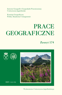
Issue 174 cover go to the issue Next

Issue 174

Publication date: 2024

Issue Editors: Justyna Liro, Agnieszka Sulikowska

Editor-in-Chief: Janusz Siwek

Secretary: Aneta Pawłowska-Legwand

Photos on the cover: Tatra Mountains – Hala Gąsienicowa; Green fields – around Racławice (photo by A.Sulikowska)

Issue content

Monika Borowiec-Gabryś, Małgorzata Zdon-Korzeniowska

Geographical Studies, Issue 174, 2024, pp. 9 - 34

https://doi.org/10.4467/20833113PG.24.001.20674
Tourism is one of the key sectors of the European economy, and tourism initiatives co-financed by the European Union support the growth of social, economic, and spatial cohesion. Diverse EU projects enhance the attractiveness of tourist destinations and increase the competitiveness of spatial arrangements of varying scales. The aim of this research is to identify the diversity of the structure of EU tourism projects in the Małopolskie Voivodeship in the context of Poland, concerning different categories of projects, and to highlight the variation among communes regarding the projects implemented, their types, and investment values. The temporal scope of the research covers the EU programming periods 2004–2006, 2007–2013, and 2014–2020. The tourism sector is not a priority in EU policy, and there remains a lack of financial instruments specifically aimed at tourism projects. However, entities seeking support can apply for funding under categories not directly dedicated to the tourism sector. During the period in question, projects related to business development, science and education, and labour and social integration played a significant role in the Małopolskie Voivodeship, while tourism projects were of considerably lesser importance within the overall number of projects supported by EU funds. It is worth noting that many tourism projects had an international character and supported regional entrepreneurship.
Read more Next

Arkadiusz Duda, Dorota Matuszko

Geographical Studies, Issue 174, 2024, pp. 35 - 57

https://doi.org/10.4467/20833113PG.24.002.20675
The study compares selected characteristics of cloud cover occurring over the centre of Kraków (urban station – Botanical Garden) and in rural areas (Kraków-Balice station) to demonstrate the impact of anthropogenic factors on cloud cover. Additionally, this aim was achieved by analysing the occurrence of specific clouds related to human activity (homogenitus), which form over the chimneys of power plants and industrial facilities or are associated with air traffic. Nephological data from two weather stations were used: one located in the Botanical Garden, belonging to the Department of Climatology, Institute of Geography and Spatial Management of the Jagiellonian University (IGiGP UJ), and the other situated at the Kraków Airport in Balice, belonging to the Institute of Meteorology and Water Management - National Research Institute (IMGW-PIB). The results indicate diverse interactions between the city and cloud cover. On one hand, there is less cloud cover compared to rural areas, especially during the cooler half of the year. On the other hand, during the summer months around midday, urbanized areas exhibit greater cloud cover, particularly from convective clouds. The analysis of specific clouds forming near industrial plants and combined heat and power plants indicates a lowering of cloud bases and an increase in cloudiness due to human activity. Moreover, the location of the airport near the city and the intensity of air traffic are related to the increasingly observed contrails, which under favourable conditions transform into special clouds.
Read more Next

Waldemar Gorzym-Wilkowski

Geographical Studies, Issue 174, 2024, pp. 59 - 77

https://doi.org/10.4467/20833113PG.24.003.20676
The aim of the study is to define the role of urban planning as a tool for urban management. Urban functional areas, which include large cities and their suburbanization zones, are a particular challenge for planning. These areas are managed by various municipal governments, while rapid and multifaceted development processes are occuring within them. Studies carried out in Lublin and its suburbanization zone indicate that spatial planning is not an effective and consistent tool for managing local space in alignment with other instruments. For instance, the way planning is carried out by the city and surrounding municipalities increases the cost of developing and operating municipal infrastructure. The reason for this phenomenon is primarily linked to systemic factors, particularly the relationship between the municipal government and residents, as well as business entities operating within the municipality.
Read more Next

Paulina Kandzia

Geographical Studies, Issue 174, 2024, pp. 79 - 104

https://doi.org/10.4467/20833113PG.24.004.20677
The proximity of large cities exerts multifaceted pressure on the areas directly adjacent to them, manifesting itself, among other things, in intensive land use. This study presents the results of research on land use intensity in the municipalities of the Częstochowa agglomeration, covering an area of 1,509 km2. The research was conducted using a modified point evaluation method. Selected diagnostic variables, that significantly influence spatial development changes were analyzed. The collected data were assigned appropriate point values, and their synthesis provided the basis for developing a scale of varying land use intensity in the analyzed area.. Selected data on building density, land cover and population density were developed using the information contained in the Corine Land Cover 2018 database, BDOT10k and resources from the Central Statistical Office. The results indicate disparities in the distribution of the analyzed factors and, consequently, the heterogeneity of the studied area. The study revealed a division of the studied settlement system into an eastern part with a lower degree of the studied phenomenon and a western part with a high degree of land use intensity. The highest values were observed for Częstochowa. Using the example of the Częstochowa agglomeration, the study demonstrates the differentiated intensity of space utilization depending on the location relative to the large urban center, which is associated with the zonal distribution of geographical environment components–both natural and anthropogenic.
Read more Next

Andrzej A. Marsz, Anna Styszyńska

Geographical Studies, Issue 174, 2024, pp. 105 - 142

https://doi.org/10.4467/20833113PG.24.005.20678
The work discusses the relationships between the intensity of the North Atlantic thermohaline circulation (NA THC), characterized by the DG3L index, and the number of days with extremely high air temperatures over Poland in the years 1951–2020. The measure of extreme conditions was the number of days in a year with maximum daily temperature ≥25°C (hot days; D5DG) and ≥30°C (very hot days; D5DU), as well as the number of days with average daily temperature ≥25°C (D5D25). Highly significant relationships were found between the variability of the DG3L index and D5DG, D5DU and D5D25, indicating that the more intense the NA THC, the more extremely warm days there are in a year. The long-term variability of the number of extremely warm days clearly refers to the variability of macro-circulation conditions – circulation epochs according to the Wangengejm-Girs classification. The increase in extremely warm days throughout the year is associated with an increase above the longterm average of the zonal macrotype W. The variability of NA THC is the cause of changes in heat resources in the waters of the North Atlantic, which affects the formation of meridional thermal gradients in the mid-troposphere. As NA THC increases, these gradients increase. As a result of the increase in these gradients, in the Atlantic-Eurasian circulation sector, there is an increase in the frequency of long waves with wave number 4 (macrotype W) and a decrease in the frequency of long waves with wave number 5 (macrotypes E and C; meridional circulation). The result is an increase in geopotential height (h500) over western and central Europe, south of 55°N. There is an increase in sea level pressure over this area, which, on the synoptic scale, causes an increase in the frequency of anticyclonic weather, without stratiform clouds (As, Ns and St; frontal), a strong increase in sunshine duration and a reduction in rainfall. In the structure of heat fluxes from land surfaces to the atmosphere, the share of evaporative heat fluxes decreases, and the share of sensible heat fluxes increases, causing a strong increase in air temperature. The strong upward trend observed in the DG3L index after 1988 is reflected in the increasing number of extremely warm days over Poland since then.
Read more Next

Barbara Pędracka, Dorota Matuszko

Geographical Studies, Issue 174, 2024, pp. 143 - 167

https://doi.org/10.4467/20833113PG.24.006.20679
The study characterises the variability of total solar radiation intensity in Krakow from 2012 to 2021. The aim of the study was to demonstrate the influence of cloud cover (cloudiness and cloud genera) and air pollution on the solar energy flux reaching the Earth’s surface. Data were collected from the Scientific Station of the Department of Climatology of the Institute of Geography and Spatial Management of the Jagiellonian University, utilising a unique 10-year period due to gaps in instrument operation in 2011. The analyses confirmed that astronomical factors primarily determine the cyclic variability of solar radiation throughout the year and day. The impact of the cloud structure in weakening and enhancing the magnitude of the energy flux was demonstrated. It was found that under cloudless weather conditions, total irradiance is reduced (by up to 20%) when the air is polluted by PM2.5 and NO2.
Read more Next

Kamila Sierpień, Andrzej Tucki

Geographical Studies, Issue 174, 2024, pp. 169 - 184

https://doi.org/10.4467/20833113PG.24.007.20680
The aim of this paper is to present Generation Z as a potential target group for an agritourism product within the relatively new cottagecore aesthetic concept. Qualitative research identified the unique characteristics, behaviours and decision-making processes of Generation Z in travel. The second part involved a primary analysis to verify the hypothesis that the cottagecore phenomenon may represent a new type of agritourism product for Generation Z. An online survey was conducted with a total of 104 people who were members of cottagecore groups on Facebook. The results of the survey showed that there is potential to use the idea of cottagecore as an agritourism product, especially among representatives of generation Z. This group shows an interest in the countryside, particularly in experiencing village life, participating in activities typical for the movement, and engaging in farm life, which corresponds well with an agritourism model enriched by the cottagecore concept.
Read more Next

Artur Zieliński, Adam Choiński, Andrzej Macias

Geographical Studies, Issue 174, 2024, pp. 185 - 226

https://doi.org/10.4467/20833113PG.24.008.20681
The research covered 26 springs and wells of cultural significance and valuable natural values in the Świętokrzyskie Voivodeship. The work was based on field observations, analysis of available literature and source materials, and information obtained from people using the described objects. The current condition of springs and wells and the method of their management, use, and protection are described. Regular reconnaissance and field studies have shown that the analyzed objects are frequently visited for water collection. Changes in springs, wells, and their surroundings were observed in most cases. The best-developed springs include the Spring of Blessed Wincenty Kadłubek in Karwów, the Spring of St. Francis in the ŚPN, the well-spring in Czyżowice and the Spring of St. Andrzej Świerad near Opatowiec, which is a well. In turn, the worst-developed object is “Pod Dębem” near Staszów. The most efficient sources turned out to be Burzący Stok (7.58 dm3·s–1), the spring in Pągowiec in Raków (1.55 dm3·s–1), and the spring in Kapkazy (1.36 dm3·s–1). It was also found that there was a lack of water in the well on the slope of Góra Witosławska and in the Zygmuntowska Well. Selected, urgent protective, and preventive measures were indicated, which, in the authors’ opinion, are necessary to preserve the described objects and associated traditions. In addition, it was recommended that the names of objects be organized.
Read more Next
Go to this issue

Indexing & Abstracting

Scientific Databases

Search engines, bibliographies, catalogs